Turn decades of imagery into a clear record of irrigated use.
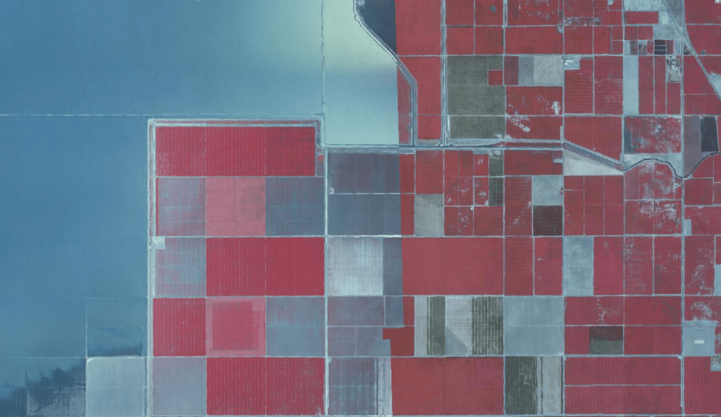
WaterWise helps landowners and professionals quickly access historical aerial and satellite archives for an area, then analyze those images to delineate irrigated areas over the years and summarize patterns of use and non-use.
Data available includes Landsat (30m resolution, 1972-Present), Sentinel-2 (10m resolution, 2015-Present), and NAIP (0.6m resolution, 2004-Present), and an abundance of high resolution aerial film imagery. Aerial film collections can be orthorectified and depending on the quality of the imagery, an elevation surface can be derived.
What we can do
- •Leverage extensive historical aerial archives & satellite imagery.
- •Delineate irrigated/vegetated extents by year or season using statistical methods and machine learning techniques.
- •Summarize use and non-use patterns over time.
- •Deliver comprehensive, digestible maps and summaries.
Questions we can answer
- “What years show clear irrigation on this field?”
- “How consistent was the footprint over time?”
- “Are there obvious gaps that need explanation?”