Precision mapping for irrigated boundaries.
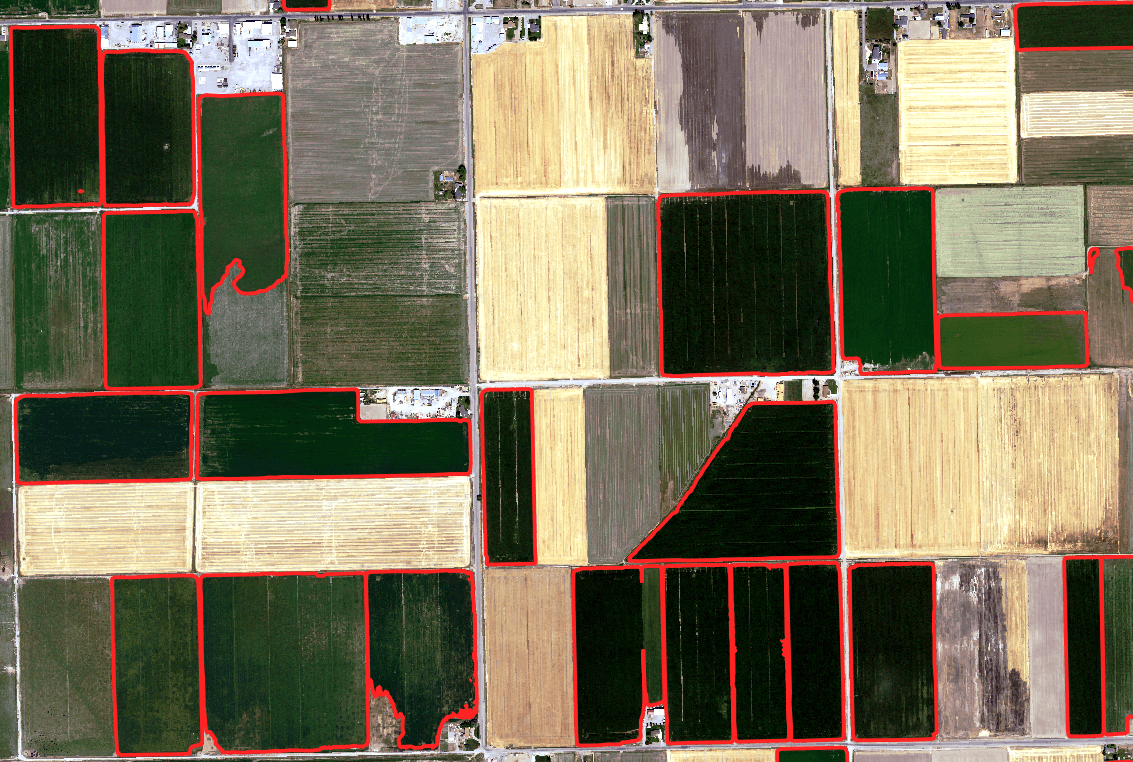
Accurately delineating irrigated acreage is critical for water rights management and regulatory compliance. WaterWise uses high-resolution remote sensing data and advanced segmentation techniques to provide precise, defensible boundaries of irrigated lands.
Using aerial imagery and multispectral satellite data, we can distinguish between different levels of irrigation intensity and provide a granular view of water application across diverse landscapes.
What we can do
- •Establish precise irrigated boundaries for any given year.
- •Calculate total acreage with high confidence.
- •Distinguish between full, partial, and incidental irrigation.
- •Provide spatial data compatible with GIS and CAD systems.
Questions we can answer
- •“Exactly how many acres were irrigated in a given year?”
- •"Which fields have the highest water consumption?”
- •“How does the mapped boundary compare to the water rights place of use?”